|
|
| |
| |
| |
|
| |
 |
| |
|
| uses Google technology and indexes
only and selectively internet - libraries
having books with free public access |
|
 |
|
|
 |
|
| |
|
| |
Previous | |
Next |
|
 |
SIR SAMUEL WHITE BAKER
CYPRUS AS I SAW IT IN 1879
page 107 View PDF version of this page advantage, there were only two farms upon which the cattle-wheels were used for purposes of irrigation, which proves the lack of enterprise and capital throughout this miserable district.
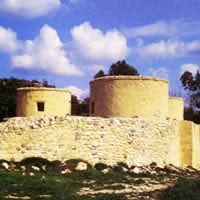
There were many important villages upon the higher ground, which overlooked the lower plain through which the river Pedias was supposed to flow. These heights were about a hundred and fifty feet above the lower level, and continued to increase their elevation for many miles, until they formed the horizJ on the south-west and west. The soil was extremely fertile, but as usual covered with stones, the débris of decayed limestone of the post-tertiary period, su l as is found throughout the Messaria. The flat val e below was about thirteen miles across due north, and1 was bounded by the Carpas range, which extendel to the east beyond telescopic view. In our front was a cheering scene, towards which we hastened with al speed ; as sailors rush on deck at the first cry M " Land ahead ! " we hurried forward at the unusual sight, " Green trees ! " Groves of tall cypress, poplars, and other varieties, springing from a base of exquisite verdure, formed a rare and unmistakable landmark. This was Kuklia, our halting-place, the property View PDF version of this page
|
|
| |
Previous |
First |
Next |
|
|
|